Adam Brouwer built New Netherland’s first mill in the mid-1640s on the banks of the Gowanus Creek. A native of Germany who served as a soldier for the Dutch West India Company in Brazil, he had arrived in New Netherland in 1642 and quickly became a respected citizen of Breuckelen. His tidewater-powered flour mill was quite far upstream, near the present-day intersection of Union and Bond streets, and by the 1660s over a dozen more farmers had opened mills or planted crops on the banks of the creek. Though his reputation would be tarnished by several brushes with the law later in the decade following the British takeover — he was arrested in 1667 for making subversive speeches and fined 500 guilders in 1669 for beating up his neighbor — in May 1664 he petitioned the colony’s council and its director general, Peter Stuyvesant, on behalf of the inhabitants of Gowanus to dredge a canal facilitating boat access to the creek and its mills.
For Brouwer and his neighbors, safe passage to Manhattan was crucial to their burgeoning business, and gaining entry to the Gowanus Creek required navigating around the point of Red Hook and through the dangerously shallow marshes in Gowanus Cove. But by dredging an existing, sand-filled kill through the Bay Ridge Flats — and effectively severing Red Hook from Long Island — the colonial government could create a narrow canal leading right to the mouth of the Gowanus that would be “fit and navigable for the passage of boats laden with a hundred skepels of grain, full of wood and other articles,” Brouwer wrote in his letter to Stuyvesant. The authorities acquiesced and dredging commenced, though the resulting channel likely never exceeded ten feet in depth. That modest intervention marked the beginning of Brooklyn’s transformation from a natural port into a manmade shipping facility, one that would become the most powerful on the East Coast over the next 250 years.
Today, that area and nearly all of the Brooklyn waterfront’s once bustling piers, wharves, and warehouses are shadows of their former selves. Thousands of pensioned union jobs have disappeared, with hundreds more on the line as real estate developers target coastal neighborhoods. As the port’s workforce has dwindled in numbers, much of its infrastructure has been converted into — or torn down to make way for — residential buildings and parks. Some of it is still there, in varying states of disrepair and reuse. Within a few blocks of the site of Brouwer’s mill, there are warehouses now filled with art galleries, studios, and light manufacturing; an abandoned power station that was briefly a thriving squat; an under-construction Whole Foods supermarket; a planned luxury housing complex with 700 apartments; and a popular bar, Lavender Lake, which gets its name from what some called the industrial waterway when it was lined with printers and textile mills, whose inks and dyes would run into the canal.
Meanwhile, New York’s port activities have become ever more consolidated in a few major facilities, mainly in New Jersey. Most shipped goods now coming to Brooklyn or other parts of Long Island are loaded onto trucks in Newark or Elizabeth and driven through the city, clogging streets with steel containers and, on their way into the borough, passing relics from the heyday of Brooklyn’s shipping industry that dot the shoreline.
The change is striking. Nature, after all, dealt Brooklyn an unusually favorable hand as a would-be port community; in 1914, the Brooklyn League, an industrial lobbying group, wrote that the borough’s shipping-friendly geography augured a “splendid future” for its industry, and even in the late 1960s, journalist Jan Morris observed after flying over New York harbor that Brooklyn “might have been man-made as a port, so neatly functional is its shape and situation.” The landscape’s innate suitability was exactly what attracted Brouwer and his neighbors to site their mills on the banks of the Gowanus in the first place, establishing an industry that would grow explosively over the next 300 years.
But Brooklyn’s advantages were not enough to keep Brouwer’s successors from moving elsewhere, and today the “splendid future” that the Brooklyn League predicted appears to have been a false prophecy. What happened?
Peak Port
Two hundred years after Brouwer’s canal was dredged, not far from the spot where those boats laden with hundreds of skepels of grain bound for his mill would have emerged from the canal across the Bay Ridge Flats before veering upstream, another newly arrived Brooklynite transformed the waterfront again. William Beard, an Irish immigrant who made his fortune as a railroad contractor, acquired a vast parcel of harbor-side farmland in Red Hook in 1843, pushing its edges out with landfill until he commanded more than one million square feet of land on the point. These became the basis for Erie Basin, a large bay protected by a curving, 2,500-foot-long breakwater that he completed in 1864. As the East Coast’s biggest purpose-built harbor and storage facility at the time, it served as the terminus for what was, along with the steamboat, the most significant engine of growth powering the New York port’s expansion in the first half of the 19th century: the Erie Canal, which opened in 1825. Grain passed through the basin on its way from America’s heartland toward overseas destinations or other parts of the republic. And as each new vessel arrived to fill its hold with grain, Beard’s basin grew both in size and in economic standing.
“He charged ships seeking to haul American cargoes 50 cents per cubic yard to deposit the rock they had carried as ballast from overseas ports,” the American Institute of Architects, in its New York guidebook, noted in an entry on the basin. “The rock then went into building the breakwater.”
On frequent walks along Beard Street, the basin’s northern edge, I pass a potpourri of Brooklyns past and present. The Civil War-era warehouses extending from the end of Van Brunt Street that nearly meet the breakwater to form the basin’s entrance house furniture workshops, refrigerated storage facilities for the nearby Fairway supermarket, artists’ studios, galleries, set, costume, and prop designers, a glass studio, and more. The next pier over, which until 2007 held the dome of the Revere Sugar Refinery, now sits completely empty while developer Thor Equities awaits the ideal big box retailer or housing complex design to begin building. Just past it sits New York City’s only Ikea store and its vast parking lot, the construction of which required the filling of a still-functioning 19th-century dry dock.
Erie Basin Park runs between the superstore and the basin atop former piers and docks, beneath stilled cranes that once unloaded hundreds of barges full of grain from the Midwest every week, stretching from Beard Street to Columbia Street. That seemingly endless dead-end stretch houses the basin’s remaining shipping activities, including the Erie Basin Marine Associates — a partnership between Reinauer Transportation and Hughes Maritime — and Container X, as well the New York Police Department’s lot for thousands of cars and trucks that are being held as evidence. The New York Water Taxi, which runs a ferry between Ikea and the Financial District, the city’s Department of Environmental Protection, which moors its ships there, and surviving shipping companies keep the basin’s waters busy enough, but they used to be all but filled from the breakwater to Beard Street with boats, tugs, and barges.
In its heyday, along with the influx of freight and ships, Erie Basin also brought a major population boom to Red Hook, albeit one that fluctuated with the seasons. “The Erie Basin was the terminus of the Erie Canal, so the population of school kids in Red Hook skyrocketed during the winter because all the canalers and their kids were in Red Hook,” explains David Sharps, the founder and president of the Waterfront Museum. “They would go to school here and then come April or May, as soon as they would open up the canal, they would be with their family on the boats and they would leave the schools.”
Sharps’s museum, housed aboard a historic railroad barge from 1914 that doubles as his family’s home, is moored near the end of Conover Street in Red Hook. When he bought it, the barge was mostly submerged, its hull filled with mud. After its excavation and full restoration, Lehigh Valley Railroad Barge #79 returned to the harbor as the Waterfront Museum in 1986, eventually settling in Red Hook in 1994. Year-round, Sharps gives tours and hosts performances and events on board, and during the summer months he organizes excursions during which visitors can ride on the barge while a tug pushes it over to Hudson River Park, Brooklyn Bridge Park, or elsewhere around the harbor.
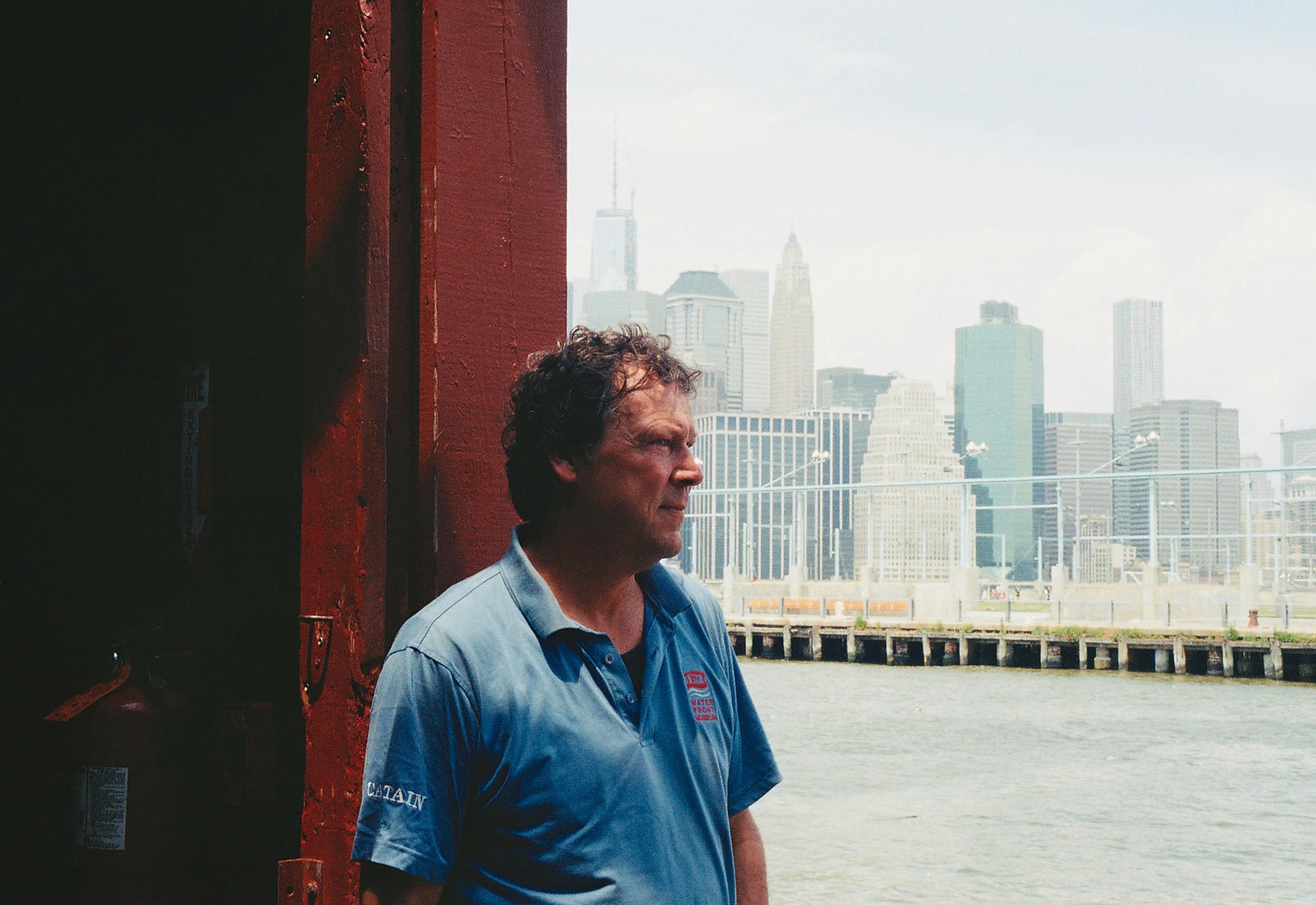
“I think historic ships are a great way to bridge the gap between the working waterfront and the general public,” Sharps says. “It’s hard to meet a tugboat captain. It’s hard to get inside of a working terminal. It’s hard to get close up on the working waterfront. And old historic vessels that were once a part of that are a great conduit that helps the working waterfront and the general public come together.”
The museum also offers a link to that earlier era of shipping, when goods were moved in bulk rather than in containers, and transferred from barge to train and back again, reaching their destinations through a combination of rail and water routes. This method, which Brooklyn’s terminals perfected from the mid-19th century onward, enabled the borough’s port to dominate the harbor by the beginning of the 20th century.
“This barge was used for break bulk,” Sharps explains. “This, if there was a ship that was docked in Brooklyn and there were goods that needed to go to Chicago or California, it could take goods over to Jersey and put them on the truck line on the railroad.”
Brooklyn’s working waterfront was in the midst of a major boom when Beard built his basin in the mid-19th century, powered in part by crucial links to trunk railway lines. By the early 1900s, the borough’s shipping activity would surpass Manhattan’s, as the latter’s waterfront became choked with smaller, older warehouses and piers. A series of expansive terminals was erected along the harbor all the way from Newtown Creek to Bay Ridge. These new facilities — like the Eastern District Terminal in Williamsburg, the Brooklyn Navy Yard in Wallabout Bay, the Jay Street Terminal in Vinegar Hill, the dozen of New York Dock Company piers jutting hundreds of feet out into the harbor between the Brooklyn Bridge and Hamilton Avenue, the Atlantic and Erie basins in Red Hook, and Bush Terminal in Sunset Park — ushered in the golden era of New York’s port, with Brooklyn as its modern center.
The first in this wave of major harbor improvements, predating Beard’s Erie Basin by more than two decades, was the Atlantic Basin, planned and executed by the merchant Colonel Daniel Richards on land he owned on the Buttermilk Channel facing Governors Island. That facility, which stretches between Hamilton Avenue and King Street, required massive alterations to the shore that would have made Adam Brouwer’s head spin. The 40-acre basin had to be substantially dredged of the mud that gives the channel its buttermilk hue just to achieve a depth of 20 feet. Richards also created some 20 additional acres of waterfront property with the excavated dirt, whereupon warehouses and storage facilities began to rise in 1844, most of them designed to store grain. The W. Beard and J.B. and G.C. Robinson Storehouses, which opened near the basin’s northern end in the late 1860s, were equipped with a pair of grain elevators. These made it easy for workers to extract cargo from the enormous vessels arriving from overseas or Canada and the Midwest, via the Erie Canal, before packing it onto smaller barges like the one housing the Waterfront Museum that could ferry it to railroad connections elsewhere in New York or New Jersey.
Now, biking through the Atlantic Basin terminal every morning, I pass an assortment of activities as eclectic as those stretched around the Erie Basin. On the south side, the Brooklyn Cruise Terminal takes up pier 12, sitting dormant for all but several dozen days per year, its giant “Welcome to Brooklyn” sign awkwardly welcoming passing Brooklynites the rest of the time. When a cruise ship does come in, the effect is surreal, as when the towering Queen Mary 2 with its seventeen decks dominates the surrounding skyline, looking as if a horizontal Empire State Building had just pulled into port. The warehouses lining the basin include a sorting center for plastic and glass recycling, a workshop producing all manner of industrial machinery and, as of very recently, a company that creates and rents props and vehicles for film and television shoots. A rental car company also operates on the expansive parking lot surrounding the basin, which is transformed one night each March by the Red Hook Criterium, a hugely popular bicycle race. One of the two giant New York Dock Company warehouses on the basin’s eastern edge has been transformed by Christie’s into a fine art storage facility, which opened in 2010. Its sister building stands partially gutted, awaiting conversion into luxury housing. Few vessels enter the basin anymore, and except on those days when a docked cruise ship attracts buses and taxis in droves, traffic is minimal.
One hundred years ago, though, the Atlantic Basin was a water-borne traffic jam of boats and barges, their contents being distributed between warehouses and waiting freight trains. Much as the arrival of the steamship had helped spur the New York Harbor’s first major boom at the beginning of the 19th century, so too did the increasingly frequent integration of rail and water shipping shape the next wave of developments. Convenient links to major commercial railroads became essential to shipping facilities’ viability and longevity, so much so that by the beginning of the 20th century plans were underway for the Marginal Freight Railway, a rail network linking all the major port facilities between the Brooklyn Bridge and Bay Ridge, much to the Brooklyn League’s delight.
“Even to-day Brooklyn is the most important arm of New York’s commerce and when the city, through the establishment of the contemplated Marginal Freight Railway, shall have given the deserved impetus to private enterprise, millions upon millions will no doubt be poured into shoreline facilities,” the League’s industrial advancement committee projected in 1914. “It is easy for the mind’s eye to picture a solid belt of terminal agencies circling the borough along its entire water border.”
While those ambitions were derailed by World War I, Brooklyn’s biggest port facilities already had their own internal freight rail systems to facilitate the loading and unloading of vessels and connect with many of the city’s trunk rail lines. By the early 20th century, most of the New York Dock Company’s holdings were connected by rail. Some of the tracks remain visible, particularly near the Atlantic Basin, though most have been scrapped amid subsequent redevelopment projects. According to a 1928 newspaper ad for New York Dock Company, its holdings included “over 180 acres of land and waterfront property, extending 2.5 miles” between the Brooklyn Bridge and the Atlantic Basin, with “34 steamship piers, 106 storage warehouses, 67 industrial buildings and 3 freight terminals,” making it “the largest warehouse and pier system in the Western Hemisphere.”
“Years ago, the way that people made money was to store things and have them when you needed them, that’s what all these storehouses were,” says Sharps. “You just stored goods, and you made money by having them when nobody else had them. And the holdings of the New York Dock Company were immense; they started over by the Gowanus, all the way up to the Brooklyn Bridge, just one after another after another.” Foremost among the goods sitting in Brooklyn’s warehouses was grain from the Midwest, though products from the South and the Caribbean like tobacco and cocoa were also stockpiled at various times.
Further up the western edge of Brooklyn, Williamsburg’s far smaller Eastern District Terminal also benefited from a connection to a freight railway, speeding the unloading of flour and hay from its main tower, which was capable of moving some 200 tons of cargo every hour. The borough’s most advanced shipping facility, however, outstripped all of these in spite of its relatively remote location on the Sunset Park waterfront, where Bush Terminal stretched from 28th Street to 51st Street.
The enormous operation was developed by Irving T. Bush and was so ambitious that in its early years it was dubbed “Bush’s Folly.” Soon the terminal employed some 25,000 workers. The son of Rufus T. Bush, a wealthy businessman who made his fortune in oil refineries, Irving Bush was born in Michigan but grew up in Brooklyn. The Bushes were descended from a Dutch settler who arrived in New Netherland shortly before Adam Brouwer presented his dredging petition to the colonial government in the early 1660s. Though he dabbled in developing early cinematic technologies, marketing Thomas Edison’s one-person moving image contraption, the kinetoscope, in the United Kingdom, after Bush Terminal’s first pier opened in 1890, Bush devoted himself to building New York’s most sophisticated shipping facility.
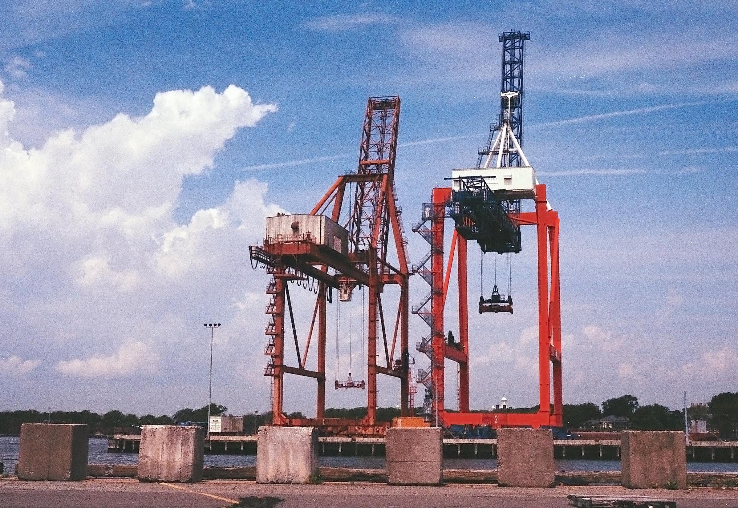
Spanning 200 acres and dotted with as many buildings rising behind its seven long, broad piers, Bush Terminal was the New York Harbor’s most advanced facility. So well suited to modern shipping and shipbuilding activities was the terminal that at the end of 1917 the US Navy took control of part of it to aid in its war efforts, displacing some 4,500 workers, before eventually hiring Bush to help design the adjacent Brooklyn Army Terminal the following year. The more than 200 manufacturers who called Bush Terminal home benefitted not only from a state of the art port facility capable of receiving freight, but also a fully equipped rail terminal. The Bush Railroad would send a train car up to a given tenant’s floor in one of the massive cast concrete loft buildings’ freight elevators, where goods could be loaded directly on board and sped off to their destination via direct links to every freight rail line in New York City. Alternately, the train cars could be rolled out onto one of the terminal’s piers and their goods loaded directly onto a barge or steamship from one of the 20 or so companies that docked there in the early 20th century.
This unparalleled integration of sea and rail shipping with manufacturing, perfected at Bush Terminal but practiced in some capacity at all of Brooklyn’s major port facilities, made the borough New York City’s leading commercial port. By 1909 its piers covered nearly 56 miles of waterfront to Manhattan’s 51.4 miles, and the goods manufactured in the borough’s factories that year added up to a total value of over $417 million (or the equivalent of just over $10 billion in today’s dollars) — an increase of one third over the borough’s annual output a decade earlier.
The reasons for Brooklyn’s growth were not lost on William Joshua Barney, a consulting engineer for the city of New York, who in 1915 praised the borough’s port facilities, particularly in comparison to competing shipping centers like Antwerp, Liverpool, San Francisco and New Orleans. “Among the most striking examples of industrial terminals in this country are those on the properties of the New York Dock Company and the Bush Terminal Company on the eastern side of New York Harbor,” he wrote. “Such industrial centers are, in reality, model terminal cities within or adjacent to the city itself, but not so interwoven with the general city activities as to cause expensive congestion in handling in and out raw goods and manufactured articles.”
This rapid growth in commerce and concomitant build-up of high-density shipping complexes earned Brooklyn the moniker “walled city,” and looking at drawings, etchings, and photographs of the port from the late 19th century and early 20th century it’s not hard to see why. Piers extended out all along the waterfront like perfectly staggered dominoes, each buffered by slips jammed with boats, while enormous storage warehouses and manufacturing loft buildings erected on adjacent streets seemed to press in against each other, forming a kind of architectural barrier on the borough’s coast. Whereas Manhattan’s docks and piers formed a ring around its skyscrapers, Brooklyn’s skyscrapers were its docks.
Sinking Ship
The two World Wars helped prolong the dominance of Brooklyn’s shipping industry, spurring demand for shipbuilding and ship repair facilities, particularly in the Atlantic Basin, and the large dry docks at the Brooklyn Navy Yard and in Erie Basin. Nevertheless, the Robins Dry Dock and Repair Company, which operated out of William Beard’s basin, had some 16,000 employees at the time of the First World War, but by 1942 its workforce had thinned to just 5,000. Several projects to modernize the port in the years before and after World War I either failed to have the hoped-for impact or never even broke ground, and at the end of World War II the borough’s shipping industry entered a steep spiral. By then freight was increasingly being moved by train rather than by water, and soon the advent of containerization and the ascendance of the trucking industry would render even the most modern of Brooklyn’s port facilities all but obsolete.
One of those new facilities was built, and still stands near the entrance to Adam Brouwer’s creek — though by then it was a canal, one whose stagnant waters were heavily polluted. The State of New York began planning the Barge Canal Terminal on the Gowanus Bay in 1909. In 1911, Albany set aside nearly $20 million for construction and equipment at 55 port facilities throughout the state, the Brooklyn terminal being its most ambitious. Completed more than a decade later, the facility boasted not only one of the most sophisticated conveyor belt systems in existence for loading and unloading freight vehicles and barges (up to 200 of which could fit into its basin), but also a towering concrete grain elevator capable of storing some two million bushels in its 54 circular bins, each one 95 feet tall with a diameter of 20 feet. The enormous and heavily mechanized terminal was, unsurprisingly, to the liking of Popular Mechanics magazine, which pronounced it a terrific success even before it went into operation.
“While we often hear it said that ‘whatever is the biggest is not necessarily the best,’ this does not apply to the New York Barge Canal Terminal at Gowanus Bay," Gordon P. Gleason wrote in the magazine’s August 1922 issue, “for this aid to traffic is not only the biggest canal terminal in the world, but is admittedly the best.”
The Barge Canal Terminal would be the last biggest or best of anything to be built in Brooklyn’s port. It failed to bring back the once-booming grain shipping and storage business that had been a hallmark of the port activities in Gowanus and Red Hook since the days of Adam Brouwer. Today the terminal sits empty and unused, despite a recent proposal to retrofit its tall bins to store cement.
Another ambitious plan for revitalizing Brooklyn’s status as a shipping center might have left an even larger relic on the borough’s waterfront had it been pursued. Set forth in the Brooklyn League’s vision for the future of the borough’s port in 1914, the scheme called for the dredging of Mill Basin to create a series of inlets and a pair of artificial islands, all of which were to be outfitted with massive docks, piers, and factories, with a link to the city’s rail system and — thanks to a new canal passing straight through Queens to Flushing Bay — to New York Harbor, the Hudson and the Erie Canal. Advising Mayor John Purroy Mitchel on how best to build this new port from scratch and administer it, former Docks Commissioner Calvin Tomkins recommended making it a freeport where raw materials could be brought, processed, and shipped out as manufactured goods without paying any duties or taxes. Thankfully this project, which would have depleted many more of New York’s indispensable and already badly damaged wetlands, never came to pass.
However delusional the plan for a Mill Basin mega-port may have been, one major infrastructural intervention might have redrawn the map for shipping in the entire region: a freight railway connection between Brooklyn and the mainland. At present, any freight removed from a vessel in Brooklyn is either loaded onto the back of a truck that must then be driven on city streets and through at least one other borough before reaching the mainland, or onto a freight train that travels more than 140 miles upstate, to Selkirk, before crossing the Hudson and making its way back down.
The solution to that costly detour has alternately been envisioned as a short tunnel beneath the Narrows to Staten Island or a much longer and deeper tunnel stretching directly across the harbor to New Jersey. Such a link would have kept the Brooklyn terminals competitive after the advent of containerization — the process of shipping goods in large metal containers that can easily be moved and stacked on immense freighters, trains and trucks, rather than traveling in bulk. If there can be said to have been a death blow dealt to shipping in Brooklyn, it was the Port Authority of New York and New Jersey’s construction of and continued investment in the sprawling Port Newark-Elizabeth Marine Terminal, which has been handling shipping containers since 1958 and by the mid-1980s was the busiest shipping facility in the world.
“Our Port Authority was created to build that tunnel that was never built,” Sharps says. “The Erie Canal became known as Clinton’s Ditch, and I always call this other one [Congressman Jerrold] Nadler’s Ditch. The very reason the Port Authority was founded was to build Nadler’s Ditch, which was the tunnel that goes from Staten Island to Brooklyn.” Though the Port Authority was created to build, operate, and maintain all links between New York and New Jersey, the freight tunnel beneath the Narrows remains one of its greatest unrealized projects.
In spite of Congressman Nadler’s ongoing advocacy for reinvestment in Brooklyn’s port terminals, they have steadily deteriorated and remain essentially disconnected from the continent’s vital freight railways. Some, like the Eastern District Terminal and many of the New York Dock Company’s holdings have been transformed into condos and parks. Other port facilities remain active but diminished.
Docked
The banks of the creek where those Dutch settlers built their mills 350 years ago are now sprinkled with cement plants, metal shops, and scrapyards, among other surviving industrial enterprises. Meanwhile, Beard’s basin and its long breakwater are now dominated by the gargantuan Red Hook Ikea. The company bought out the only remaining ship repair facility in the Erie Basin and filled in its dry dock to create its sprawling parking lot and waterfront esplanade. Nevertheless, the basin is still home to one of the borough’s most active fleets of barges and tugboats, which belong to Erie Basin Marine Associates. Nearby, the once-revolutionary Barge Canal Terminal’s enormous grain elevator looms large and empty, while John Quadrozzi Jr.’s adjacent Gowanus Bay Terminal deals in cement, scrap metal, reclaimed woods, and rock salt.
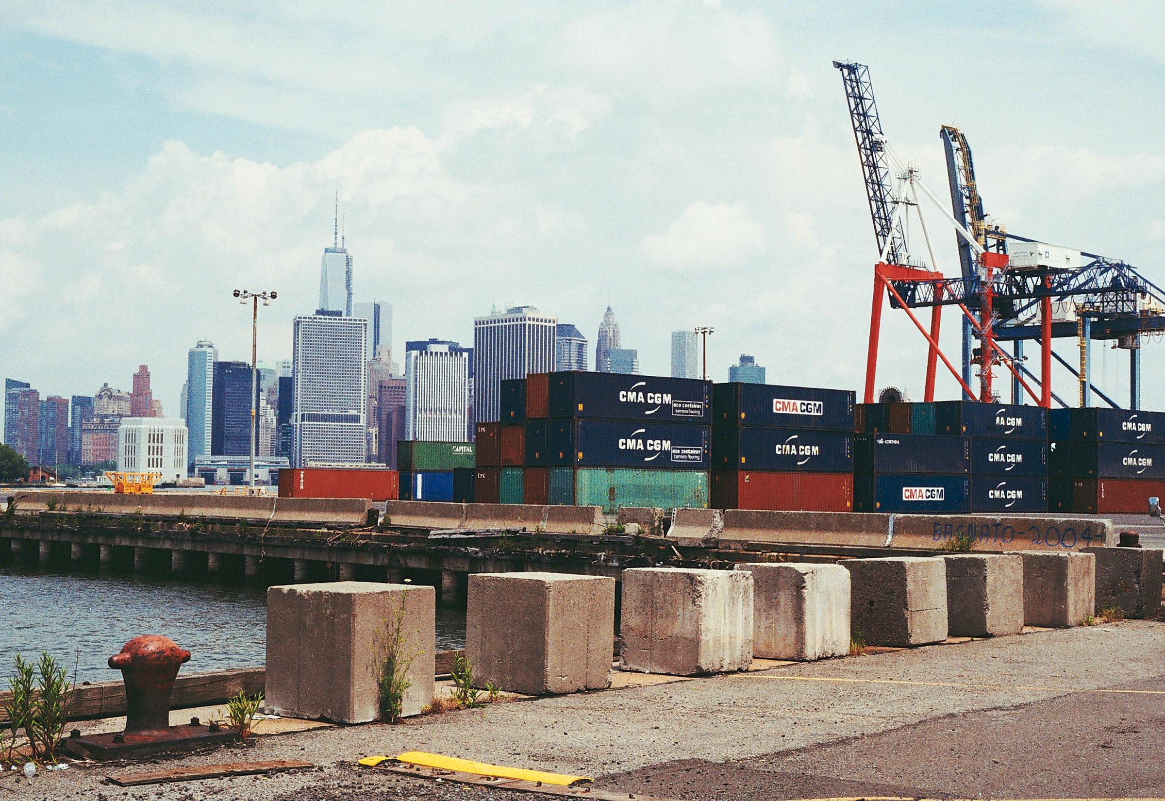
Colonel Daniel Richards’ Atlantic Basin has likewise undergone a partial transformation with its fine art storage facility, still-incomplete luxury housing, and the Brooklyn Cruise Terminal, which began receiving the world’s biggest passenger vessels in 2006. Meanwhile piers 7 through 11 are home to the Red Hook Container Terminal, the borough’s biggest, stretching between Atlantic and Hamilton avenues. It had been operated by American Stevedoring since 1994, until the Port Authority took over in 2011. Now the facility is leased to Phoenix Beverages, whose shipments of imported beer accounted for some 40 percent of Red Hook’s port activities in 2012.
For several years, though, the Atlantic Basin and the other piers operated by American Stevedoring were targeted for redevelopment, with Mayor Michael Bloomberg’s administration plotting to relocate Red Hook’s container port to the former Bush Terminal in Sunset Park. Prior to the recession there had even been talk of converting pier 11 into a second cruise ship terminal and erecting condos, a hotel, and possibly a bridge to Governors Island at the basin. The advent of the recession in 2008 and consequent slowing of waterfront residential development put an end to those plans, and the future of the Red Hook Container Terminal seems fairly secure — even if its only major import is beer.
Irving T. Bush’s facility has also been partially repurposed, while maintaining some shipping activities. Now dubbed the South Brooklyn Marine Terminal, two of its waterfront piers, between 33rd and 39th streets, are operated by the Axis Group, which traffics in cars. Directly behind Axis’ sprawling parking lot, many of the large warehouse and manufacturing buildings that once made up “Bush’s Folly” have since been rebranded as Industry City and are in the midst of a decade-long modernization. Their spacious converted units are rented out by artists, light industry, tech startups, textile companies, and innumerable other types of tenants.
Unfriendly Waters
The Brooklyn coast is now completely transformed from the marsh-filled coves that Adam Brouwer navigated on the way to his mill in the 1660s, but today’s merchants, like those from Brouwer’s day, depend on government for survival. Just as the Gowanus Creek mill owners petitioned the governor to improve conditions for waterborne commerce, so today are the companies responsible for the borough’s enduring shipping activity beholden to organizations like the Port Authority, the city’s Economic Development Corporation and, on the Gowanus Canal and Newtown Creek, the Environmental Protection Agency. In the mid-2000s the Port Authority was subsidizing the Red Hook Container Terminal to the tune of $5 million every year. It remains to be seen how the Superfund cleanup projects on what were at various times the continent’s busiest industrial thoroughfares — in 1910 boats traveling along Newtown Creek’s four miles had a total tonnage greater than the combined tonnage of all the other canals in New York State — will impact local enterprises. While luxury housing and park development has replaced or transformed many of the borough’s celebrated piers, increased concerns about rising sea levels and coastal flooding may still slow their encroachment at sites like the Atlantic Basin or Bush Terminal.
Those former hubs will never see a return to the bustling commerce of their glory days, especially without the Cross-Harbor Rail Tunnel. Nevertheless, some still argue for maintaining and, where necessary, even subsidizing the Brooklyn shipping industry. Councilman David Yassky succinctly explained the port’s appeal to the Times in 2006, when the city seemed poised to move the Red Hook Container Terminal to Sunset Park: “Shipping creates excellent-paying jobs for people who don’t compete in the high-tech economy, and it keeps trucks off the roads.”
In other words, every container that is unloaded in Brooklyn rather than at the Newark-Elizabeth Marine Terminal is one less container that will have to travel on the back of a truck through New York City’s streets, or on a freight train some 146 miles out of its way via the Selkirk Loop. Meanwhile, the jobs supported by the industry, though far fewer in number than the thousands employed at the port’s peak and further thinned by the increased mechanization of port facilities — last year some 700 men and women worked at the Red Hook Container Terminal — are among the precious few well-paid blue-collar jobs remaining in the borough. “It means a lot of jobs and gives us a major industrial base that will make up for some of the losses on Wall Street, if we do it right,” Congressman Nadler said in 2008, after the Terminal was very nearly shut down for redevelopment.
Whether concerns about quality of life, economic diversity, and the efficient and ecological transportation of goods will be enough to keep the borough’s shipping terminals in business rests largely in the hands of the city and the Port Authority now. In a borough whose residents increasingly prize the shoreline as a recreational space, it may be that investment in a working waterfront is no longer a part of a “splendid future,” but rather of an all but forgotten past.